


Robert Campbell Highway (Hwy #4)
The Robert Campbell Highway is one of the main highway routes in the Yukon Territory for traveling throughout the region. The route explores the remote and often rugged wilderness landscape throughout the central portion of the Yukon.
 The rough highway route provides access to the Yukon communities of Watson Lake, Ross River, Faro and Carmacks. The Robert Campbell Highway connects with the Alaska Highway in the community of Watson Lake and the Klondike Highway in the communty of Carmacks. In Ross River the Robert Campbell Highway connects to Canol Road.
The entire Robert Campbell Highway is measured at 562 kilometres (362 mi.). There are endless kilometres of forest, many rivers and creeks, some rugged canyons, wildlife sightings, wetlands and many long stretches of road with no civilization or services.
Most of the middle part of the highway is gravel road and loose pebble. The highway can be rough on vehicles and paint jobs. The highway is heavily marked with pot holes. Luckily, the pot holes and rough sections of the highway are identified by small orange flags.
There is a couple simple things to keep in mind when traveling the Robert Campbell Highway. Two important ones are to always have your seatbelt and headlights on. We would also advise to travel away from the imaginary centre line to avoid flying rocks from approaching vehicles, watch for wildlife, ,always travel with a spare tire and never take a chance on having enough gas.
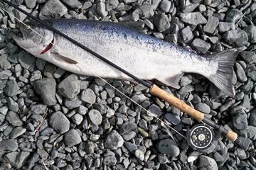
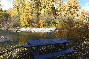
When traveling from Watson Lake to Carmacks there are many highlights along the way. Some of the highlights include the picnic area on Frances River located 54 kilometres north of Watson Lake. At the 83 kilometre mark is Simpson Lake and a picnic area with fishing opportunities. And then there is also Finlayson Lake with a picnic area, boat launch and viewpoint near the 240 kilometre mark.
The Robert Campbell Highway crosses many creeks and rivers. The list is huge. Some of the creeks include the Ketza, Bruce, Starr, Mink, Big Campbell, Little Campbell, Finlayson, Wolverine, Van Bibber, Light, Dick, Money, Caesar, Mile, Tom, Simpson and McDonald Creeks. The rivers include the Tuchitua, Pelly, Yukon, Ross and Hoole Rivers. Many with bridges - some are one way wooden bridges, metal bridges or log bridges.
Some of the scenic highlights enjoyed along the trip include the deep rugged walls of the Lapie Canyon and the many opportuntiies for wildlife sightings. There are opportunities to view wildlife like porcupines, beaver, moose, Black Bears and various birds.


")


