Chilkoot Trail

Trail Length: 53 kilometre
Difficulty: Difficult
Park Amenities:
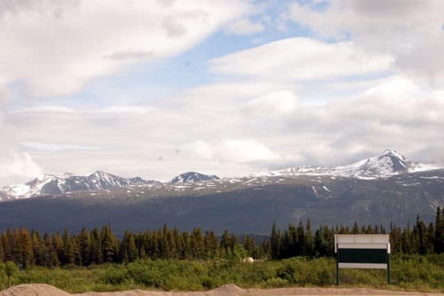
The Chilkoot Trail is an opportunity to backpack some of the Yukon's most rugged wilderness terrain. The trail explores through many various eco systems and experiences ever changing weather conditions. The backpacking route explores the Pacific Northwest Coastal Forest region, the Boreal Forest and the alpine tundra with elevations reaching 1064 metres (3,535 feet).
The route is the most famous hiking and backpacking adventure in the Southern Lakes region of the Yukon Territories. The first to explore the route was an American by the name of Schwatka who was commissioned by the American Government to survey the transportation route leading to the Yukon River.
The travels of Schwatka established what is now the historic Chilkoot Trail and Yukon Pass route. It is the same backpacking route used by miners and prospectors during the Yukon Gold Rush to travel from Skagway, USA to Carcross, Yukon, Canada.
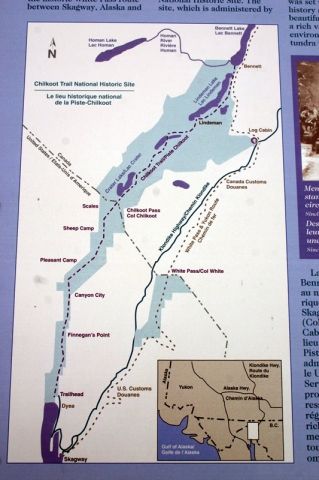
The route begins at sea level in Skagway in the abandoned Gold Rush town of Dyea. Dyea is the southern trailhead entrance of the Chilkoot Trail. The Log Cabin Historic Site located south of Carcross, Yukon on the South Klondike Highway is the northern trailhead entrance. From one end of the trail to the other should take 4 -7 days depending on the size of your group and fitness levels.
From Dyea, the first section of the trail is relatively level, easy grade hiking following the banks of the Taiya River. There is a wilderness campsite, pit toilets and parking in Dyea. Only 50 backpackers a day are permitted on the trail so book ahead. All need to register with Parks Canada to access the route and pay a parks fee. Peak times on the trail are in July and August.
The Chilkoot Trail is well marked in the trees, but in the alpine tundra the trail gets tricky as visibility can be poor and the trail is marked by rock cairns and flag poles. The trail, thankfully monitored by park rangers explores rough terrain, sometimes snow covered terrain, with exposed boulders, mud and tree roots.
Weather and temperature can change quickly and drastically on the Chilkoot Trail. It is important to always prepare for all types of weather on this route, even prepare for snow in the summer. It does not pay to take shortcuts in the wilderness.
The route provides a good opportunity to view nature surviving in various harsh climates. On the southern end of the trail, at the lower elevations of the hike, are trees like western hemlock, sitka spruce and aspen. The ground cover is moist with plant species like devils club. mosses and families of ferns. Wildlife in the area includes Grizzlies, Black Bears, Bald Eagles and otters.
The alpine tundra section of the Chilkoot Trail is a different story. The trail is more of a breadcrumb route following rock cairns. The surface barren and moon like in some areas. Plant life is tough and sparse in the alpine clinging to the ground for dear life. There are patches of lichens, wind battered willows and shrubs. Wildlife living in the alpine may include pikas, mountain goats and marmots.
On the northern end of the trail at the lower elevations, on the downside of the alpine tundra, is the Boreal Forest. It is a forest of lodgepole pine, fir and alder trees. Wildlife living in the forest includes Grizzlies, Black Bears, wolves, wolverrines and moose.
The Chilkoot Trail starting from Dyea (Southern Trailhead).
Kilometre 7.7 - Finnegan's Point on Taiya River. There is a wilderness campsite, pit toilets and shelter.
Kilometre 12.1 - Canyon City on the Taiya River. There is a wilderness campsite, shelter and pit toilets. 1/2 a kilometre north of camp, on the opposite side of the river, are the Canyon City Ruins- a historic site.
Kilometre 16.9 - Pleasant Camp - Wilderness campsite, pit toilets and shelter.
Kilometre 20.3 - Sheep Camp - Popular Wilderness campsite right before the big climb through Chilkoot Pass. Wilderness campsite, food cache, pit toilets and shelter.
Kilometre 25.3 - The Scales (watch your footing)
Kilometre 26.6 - Chilkoot Pass - Wilderness campsite, shelter and pit toilets
Kilometre 27.4 - Crater Lake
Kilometre 33 - Happy Camp - Wilderness campsite, pit toilets and shelter
Kilometre 41.8 - Lindeman City on Lindeman Lake - Wilderness campsite, pit toilets and shelter.
Kilometre 46.7 - Bear loon Lake Camp on Bear loon Lake - Wilderness campsite, pit toilets and shelter
Kilometre 53 - Bennett Lake - Northern trailhead - Wilderness campsite, pit toilets and shelter
Explore the Chilkoot Trail National Historic Site in Carcross, Southern Lakes, Yukon Territories, Canada
Address:
How To Get ToChilkoot Trail
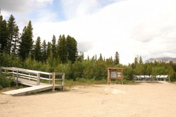
:North Trailhead: Travel south from Carcross, Yukon Territory via the South Klondike Highway to the Log Cabin Historic Site. The Log Cabin landmark is the site of the northern trailhead entrance to the Chilkoot Trail. The site is well marked from the highway. There are information boards, pit toilets and trail leading to Bennett Lake. No camping here. Campsite is at Bennett Lake.


