Warning: Name field for this section is disabled or deleted. This results in unexpected behaviour!

British Columbia Parks and Trails

Planning adventures in our British Columbia Parks and Trails

Parks, hiking trails, historic sites, heritage sites, rivers, lakes and natural areas in BC Canada

British Columbia parks and trails in Canada covers every type of landscape and seascape including mountain ranges, rivers, lakes, glaciers, forests, wetlands, wildlife, ecological and heritage. All play a big part in the creation of our BC parks system. Some of our BC Parks and heritage trails tells the long history of Canada. Others are for protection of wildlife, floral and fauna. Then there are those strictly designed for adventures and leisure living outdoors. There are over 11,400,000 hectares of BC parkland in Canada with over 2,700 kilometres of hiking and mountain biking trails.
British Columbia Parks & Trails

Over 800+ BC Parks in the province 

There are over 800 or so British Columbia parks in Canada. This, by no means, is the total number of wilderness and recreation parks in British Columbia, Canada as there are many others that do not fall under the Provincial umbrella. Other parks in the province includes a few National parks and many smaller community, regional, hyro and forestry recreation parks located throughout the province. Only 12.5% of our province is protected by BC Parks and 0.6% is protected by National Parks.

British Columbia Parks and Trails in Canada Summary

British Columbia parks and trails are used for many occasions and activities. The Khutzeymateen Provincial Park is Canada's only grizzly bear sanctuary. The Tweedsmuir Provincial Park is British Columbia's largest provincial park covering 989,616 hectares. On Vancouver Island the 440 metre Della Falls in Strathcona Park is Canada's highest waterfall and is one of the ten highest falls in the world!

Parks are an important part of our province providing thousands an opportunity to enjoy the wilderness outdoors. It is said 6 out of 10 people living in BC visit a park every year.

The British Columbia parks and recreation sites are here for yours and our tourism enjoyment. Please help us care for them and respect them. Do not leave garbage behind. Do not feed the wildlife. Always ask questions on the services, amenities, fees and rules to live by when in the park.

British Columbia Parks and Trails in Canada

Click the BC Regions below to view parks, trails and places in that area.
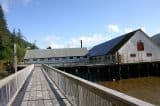
port_edward_historic_fishing_village8
A unique fishing village situated on pylons and rustic docks connected by raised wooden boardwalk paths leading to spanning views overlooking Inverness Passage.
Read more
Hwy 44
Prince Rupert
upana
Upana Caves, a spelunking destination, is located near the community of Gold River, BC on Vancouver Island, Canada. The caving destination provides over 100 caves. There are said to be around 1 000 known caves on Vancouver Island. Who knew? Most of these caves are found in what is called the Quatsi
Read more
maple bay
Maple Bay is a small marine village located east of the community of Duncan, BC on Vancouver Island, British Columbia, Canada. The village is in private cove, fronted by a pebbled beach, situated on the shores of the Sansum Narrows. Maple Bay is a residential neighborhood located about 10 minutes
Read more
Maple Bay Road
Duncan
petroglyphs
Petroglyph Park is historic park located in the community of Nanaimo, BC on Vancouver Island, British Columbia, Canada. The 2 hectare park is the site of prehistoric carvings and provides many opportunities for good marine views.
Read more
Nanaimo
tex
The Tex Lyon Trail is a historical hiking trail dating back to the 1940s when the north end of the island was in a deep state of discovery. The hiking trail was a trail used by people traveling between Port Hardy and Fort Rupert, British Columbia, Canada. The trail is a little used route today whic
Read more
Port Hardy
soames_hill_trail_and_soames_point 008
Soames Hill is a straight up 1 km (0.6 mi.). A steep hike, with hundreds of stairs, that rewards you in two ways.
Read more
Bridgeman Road
Langdale
kootlake
Kootenay Lake is the adventure and activity destination of choice for canoeing, fishing, kayaking, boating, swimming, wind surfing, and SUP
Read more
Nelson, Kaslo, Creston
ssmoyie
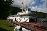
The SS Moyie is recognized as a National Historic Site and a BC Landmark. The well maintained and restored paddle wheeler is a historic museum. Inside are displays of pictures, artifacts and models depicting the history of the early 1900s living life on Kootenay Lake.
Read more
Front Street
Kaslo
burnaby-central-park
Central Park is located in Burnaby, BC. The park measures over 90+ hectares and is situated on the border of Downtown Vancouver and Burnaby.
Read more
Kingsway Street
Burnaby
spit
Sidney Spit of the Gulf Islands National Park Reserve is a long sand bar and marine park measuring over 223 hectares (551 acres) of foreshore and over 177 hectares (437 acres) of upland landscape highlighted by a seamlessly endless white sandy beach.
Read more
Sidney
campsite
Juniper Beach Provincial Park is a small campground park surrounded by a few trees, sagebrush, juniper and pear cactus located on the shores of the mighty Thompson River east of the community of Cache Creek, British Columbia, Canada.
Read more
Highway 1
Cache Creek
moricetown-rapids01
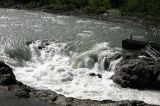
Moricetown Canyon is the home of the Wet'suwet'en First Nation people - one of the five First Nation communities located on or near Hwy 16. The main attraction is the Bulkley River, the Morice Canyon, the fish ladders and the wooden fish huts used for fishing.
Read more
Highway 16
Smithers
elliotbeach5
Elliott's Beach Park is a small pebbled beach located in the Cowichan Valley, northeast of Ladysmith, British Columbia, Canada on Vancouver Island. The beach park is situated in a small quiet bay, surrounded by rock outcroppings, in an area of Ladysmith referred to as Yellow Point.
Read more
Elliott Way
Ladysmith
kasan_eagle_house01
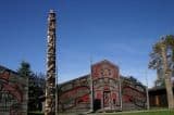
Kasan First Nation Village in Old Hazelton, British Columbia, Canada is a once-in-a-lifetime opportunity to visit with the history, art and culture of the Gitxsan First Nation people.
Read more
Highway 16
Old Hazelton
grant-narrows
The Grant Narrows Regional Park is situated on the southern shores of Pitt Lake and on the banks of the Pitt River. However... it is an enclosed park surrounded by dykes and nearby wetland, bog and marsh areas - most notably the Katzie Marsh and the Pitt-Addington Marsh Wildlife Management Area.
Read more
Rannie Road
Pitt Meadows